

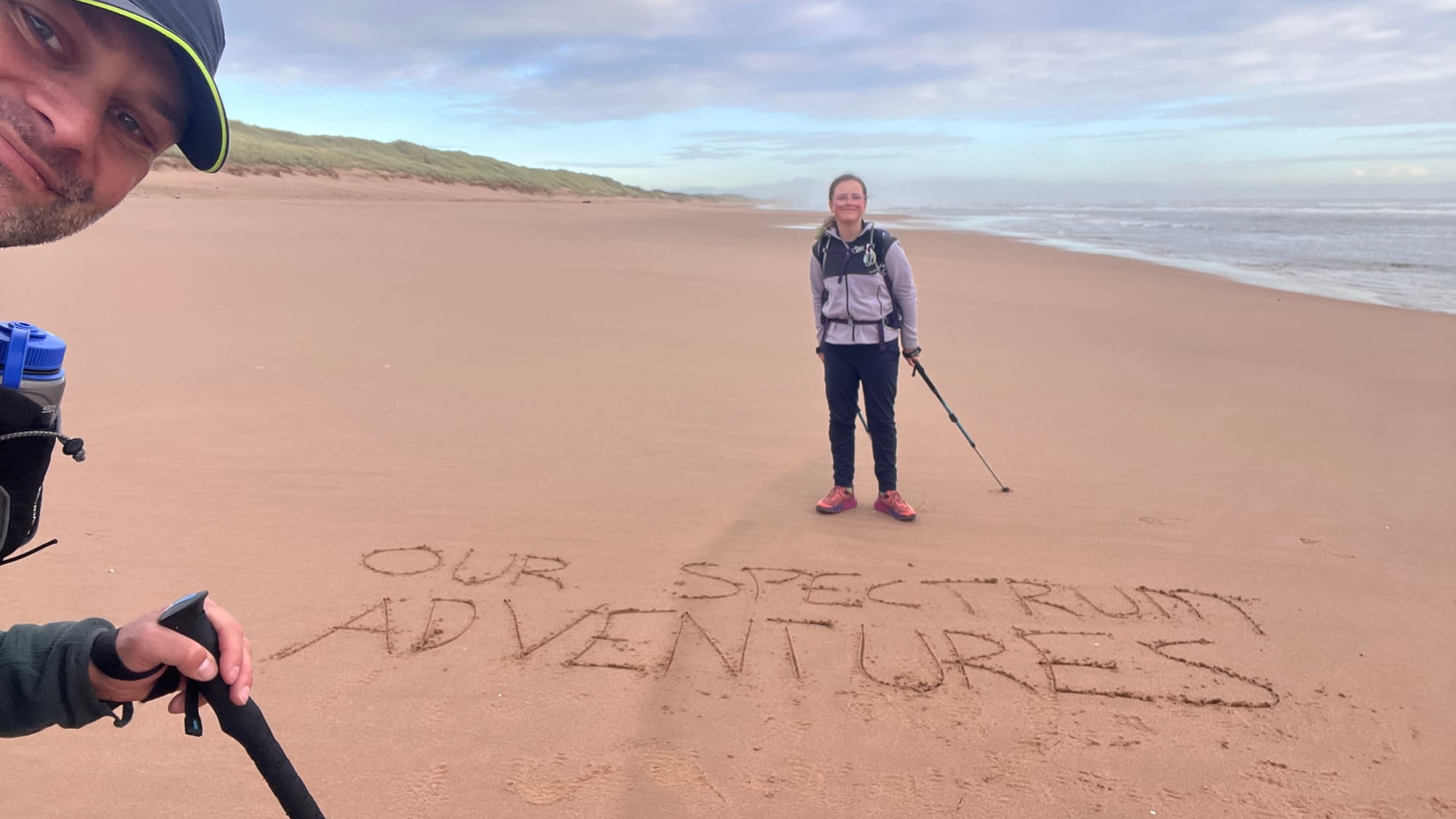
Walking the coast of Great Britain
Together, we are walking the entire coast of Great Britain with a straightforward plan: stay as close to the coast as possible, and keep walking! As long as we have the sea to our right (or left), we're walking in the right direction.
We only stop walking for safety, financial, or logistical reasons, or when we find a great wild camping area to spend the night!
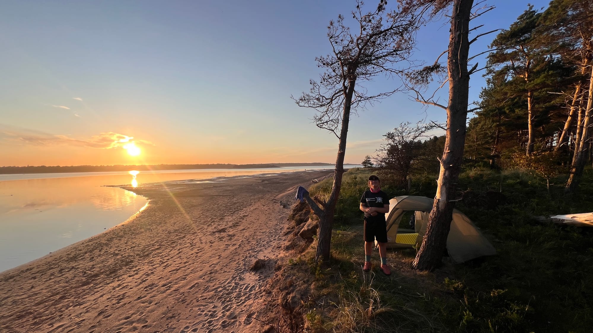
Our home is our tent. We carry everything we need in our backpacks, from food and medical supplies to Eve’s home education resources. We always wild camp and don’t use campsites or accommodation. We also don’t use B&Bs, hotels, etc, including cafes, coffee shops, and bakeries, as they are vastly beyond our budget! If you would like to support us by buying us a coffee or cake, we have a Buy Me a Coffee page. Thank you!
I post daily updates on our Facebook page; however, we add lots more photographs, videos, stories and information to this website and blog whenever we can! Please consider subscribing to stay updated!
Why hike the coast?
Starting to hike the British coast was a continuation of what we had begun during the JOGLE walk. We planned to walk home to Stirling, Scotland, via the coast after completing JOGLE. However, due to personal reasons, we had to abandon this plan and instead hike all of Scotland’s Great Trails. (My mother had a stroke.) We are now continuing to walk the coast, albeit starting from a different location.
We are walking clockwise around Britain, linking some of Scotland’s Great Trails that we have hiked. (A few coastal sections that we have already walked, we walked counterclockwise)
For hiking the coast, we consider our starting point to be Berwick-upon-Tweed on the English-Scottish border.
How far have we walked?
Cockburnspath to Berwick-Upon-Tweed
The section between Berwick-Upon-Tweed and Cockburnspath is better known as the Berwickshire Coastal Path. We’ve hiked the Berwickshire Coastal Path multiple times, including as part of our Scotland’s Great Trails charity walk.
The typical direction of travel on the Berwickshire Coastal Path is south; consequently, this is one of the coastal sections we walked anticlockwise!
- Cockburnspath to Fast Castle (Berwickshire Coastal Path)
- Fast Castle to St Abbs (Berwickshire Coastal Path)
- St Abbs to Eyemouth (Berwickshire Coastal Path)
- Eyemouth to Berwick (Berwickshire Coastal Path)
- Cockburnspath to Barns Ness Lighthouse
- Barns Ness Lighthouse to John Muir Country Park
- John Muir Country Park to Seacliff beach
- Seacliff beach to Broadsands, North Berwick
- Broadsands, North Berwick to Ferny Ness, Longniddry
- Ferny Ness to Drummohr (John Muir Way)
- Drummohr to Musselburgh (John Muir Way)
- Musselburgh to Cramond (Edinburgh)
- Cramond Island
- Cramond to North Queensferry (Edinburgh)
- North Queensferry to Inverkeithing (Fife Coastal Path)
- Inverkeithing to Aberdour (Fife Coastal Path)
- Aberdour to Kirkcaldy (Fife Coastal Path)
- Kirkcaldy to Leven (Fife Coastal Path)
- Leven to Elie (Fife Coastal Path)
- Elie to Anstruther (Fife Coastal Path)
- Anstruther to Crail golf course (Fife Coastal Path)
- Crail golf course to St Andrews (Fife Coastal Path)
- St Andrews to Tentsmuir car park (Fife Coastal Path)
- Tentsmuir to Newport on Tay (Fife Coastal Path)
- Newport on Tay to Carnoustie
- Carnoustie, West Haven to Carlingheugh Bay
- Carlingheugh Bay to Lunan Bay
- Lunan Bay to Montrose Bay
- Montrose Bay to Haughs Bay, Johnshaven
- Haughs Bay, Johnshaven to Catterline
- Catterline to Skatie Shore, Stonehaven | Gallery
- Skatie Shore, Stonehaven to the north of Portlethen | Gallery
- North of Portlethen to Aberdeen | Gallery
- Aberdeen to Belmedie Beach | Gallery
- Belmedie Beach to Hackley Head / Forvie Ness | Gallery
- Hackley Head / Forvie Ness to Whinnyfold | Gallery
This is where we are up to as we walk north towards Cullen and Inverness.
Cullen to Forres
Cullen to Forres is better known as the Moray Coastal Trail. We walked the Moray Coastal Trail as part of our charity walk to complete all of Scotland's Great Trails. The Moray Coastal Trail is normally walked eastward (anticlockwise), so that's what we did.
- Forres to Findhorn Bay
- Findhorn Bay to Roseisle Forest
- Roseisle Forest to Silver Sands
- Silver Sands to Lossiemouth/Kingston
- Lossiemouth/Kingston to Buchie
- Buchie to Cullen
Golspie to Dunnet Head
We walked the coast from Golspie to Dunnet Head (except for a small section around John O'Groats, where we diverted inland) as part of our John O'Groats to Lands End (JOGLE) charity walk. We also walked this heading south, so anticlockwise!
We have considered walking this section again because, during our previous attempt on JOGLE, the weather on the coast was so extrem and dangerous, it forced us to retreat onto the A9 to continue walking south!
- Dunnet Head to East Mey
- Easy Mey to John o’ Groats
- John o’ Groats to Freswick Bay (south)
- Freswick Bay (south) to Keiss
- Keiss to Wick
- Wick to the centre of Wick
- Wick centre to Whalogie
- Whalogie to Lybster
- Lybster to Dunbeath
- Dunbeath to Berriedale
- Berriedale to Portgower
- Portgower to Brora
- Bora to Golspie
Mull of Galloway to Stonykirk
Mull of Galloway to Stonykirk is part of the Mull of Galloway Trail. We walked the Mull of Galloway Trail as part of our charity walk to complete all of Scotland's Great Trails.
We may still walk this small section again, depending on logistics and time available.
- Mull of Galloway Lighthouse to New England Bay
- New England Bay to Stonykirk
Kincardine Bridge to Newburgh
Kincardine Bridge to Newburgh is the Fife Coastal Path. We walked the Fife Coastal Path as part of our charity walk to complete all of Scotland's Great Trails.
- Kincardine Bridge to Crombie
- Crombie to Inverkeithing
- Inverkeithing to Aberdour
- Aberdour to Kirkcaldy
- Kirkcaldy to Leven
- Leven to Elie
- Elie to Anstruther
- Anstruther to Crail (golf course)
- Crail (gold course) to St Andrews
- St Andrews to Tentsmuir car park
- Tentsmuir to Woodhaven
- Woodhaven to Pittachope parking area
- Pittachope parking to Newburgh
Glen App to Wemyss Bay
Glen App to Wemyss Bay is better known as the Ayrshire Coastal Trail. We walked the Ayrshire Coastal Trail as part of our charity walk to complete all of Scotland's Great Trails.
- Glen App to Currarie Port
- Currarie Port to Bennane Head
- Bennane Head to Woodland Bay
- Woodland Bay to Girvan
- Girvan to Maidenhead
- Maidenhead Bay to Bracken Bay
- Bracken Bay to (between) Prestwick & Troon
- Between Prestwick & Troon to Irvine
- Irvine to Stevenston Beach
- Stevenston Beach to Portencross Castle
- Portencross Castle to Largs
- Largs to Wemyss Bay
Barnstable to Land’s End
Barnstable to Land's End forms part of the South West Coastal Path (SWCP) and is one of England and Wales' National Trails. We walked this section as part of our JOGLE.
Barnstable to Land's End forms part of the South West Coastal Path (SWCP) and is one of England and Wales' National Trails. We walked this section as part of our JOGLE.
- Barnstable (just over the river Taw) to B236 (near) Buckleigh
- B236 (near) Buckleigh to Buck’s Cross
- Buck’s Cross to Clovelly
- Clovelly to Hartland Point
- Hartland Point to Hartland Quay
- Hartland Point to South Hole
- South Hole to Duckpool Beach
- Duckpool Beach to Widemouth Sands
- Widemouth Sands to Crackington
- Crackington to Boscastle
- Boscastle to Trebarwith Strand
- Trebarwith Sand to Port Issac
- Port Issac - Tregunna
- Tregunna to Constantine Bay
- Constantine Bay to Trenance
- Trenance to The Gannel, Newquay
- The Gannel, Newquay to Perranporth
- Perranporth to Chapel Porth
- Chapel Porth to North Cliffs car park near Coombe
- North Cliffs car park near Coombe to Hayle
- Hayle to Porthminster Beach, St Ives
- Porthminster Beach, St Ives to Portmear Beach, St Ives
- Portmear Beach, St Ives to Zennor
- Zennor - Trevean Cliff
- Trevean Cliff to (north of) Nanquidno
- (north of) Nanquidno to Lands End
Lands End to Lizard Point
Lands End to Lizard Point is part of the South West Coastal Path (SWCP), one of England and Wales' National Trails. We walked this section as part of our JOGLE; however, we had to stop hiking at midday every day so Sarah could pick us up, as we had some family issues to deal with.
- Lands End to Penberth Cove
- Penberth Cove to Newlyn Quarry
- Newlyn Quarry to Perranuthnoe
- Perranuthnoe to Tremearne Farm (day of mum’s Stroke)
- Tremearne Farm to Poldhu Cove
- Poldhu Cove to Higher Predannack Wollas
- Higher Predannack Wollas to Kynance Cove
- Kynance Cove to Lizard Point


Comments