

The Affric Kintail Way
We backpacked the Affric Kintail Way over 5 days, starting in Drumnadrochit and finishing in Morvich. We wild camped every night and walked between 10 and 13 miles each day. The Affric Kintail Way gave us an amazing experience, and we can highly recommend it to you, whether you're a beginner or an experienced hiker.
In this article, I’ll share some of our experiences, what we learned, what we’d do differently, and offer you some helpful advice for successfully completing the Affric Kintail Way, including a few logistical hints you might not have thought of.
Stop seeing adverts and support us
When you become a member, you will stop seeing adverts & get articles delivered to your inbox for FREE.
What this article covers
- Sections, terrain and difficulty
- Waymarks and navigation
- Wild camping and accommodation
- Availability of water, resupplying and other facilities
- Highlights, dangers and warnings
- Midges, Clegs, Ticks and other beasties
- Safety and phone signal (The Affric Kintail Way is notorious for poor phone signal)
- Other considerations and advice
Drumnadrochit to Cannich
Drumnadrochit, located on the banks of Loch Ness, is busy and touristy with no shortage of accommodation, shops and cafes. Public transport is provided by several bus services and taxis. Drumnadrochit doesn't have a train station. Attempting to list all the business and transport options would be pointless, when a Google search will give you more relevant and up-to-date information than I can. What I can tell you is that Drumnadrochit has a co-op, pharmacy, youth hostels, and a large pay-and-display car park in the centre, along with all the essentials any hiker would need.
The Loch Ness Hub is located in the car park in the centre of Drumnadrochit, an amazing community-owned and run resource with a shop, public toilets, information centre and even a full campervan service area! They offer just about everything you could need or want, including taxi services and baggage transfer! Amazing!
Start of the Affric Kintail Way
The ‘official’ start of the Affric Kintail Way is underwhelming. There is no defined location that marks the start (or end) of the Affric Kintail Way, as there is on many other trails. I feel this is a real shame. Having a plaque or small acknowledgement for the beginning and end wouldn't be too difficult to install and would elevate the trail no end! For most people, including us, the start of the Affric Kintail Way is in front of the information plaques, located at the corner of the main car park. From here, looking towards the road, you will also see your first of many Affric Kintail Way waymarkers that will guide you along the length of the trail.
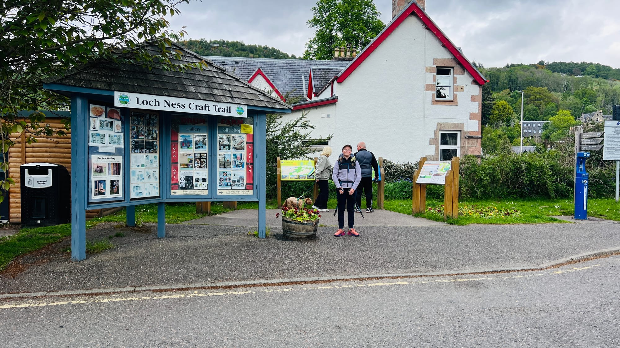
Walking out of Drumnadrochit, you will soon find yourselves on forest paths. The section between Drumnadrochit and Cannich mainly involves walking on forest paths and trails; however, don't let that put you off! So many people advocate starting the Affric Kintail Way at Cannich, but I feel this is a mistake. The forest trails from Drumnadrochit are highly varied, ranging from commercial forestry to old woodlands teaming with wildlife and flora. The trail is solid underfoot, and the plentiful signage means you will barely need to check your map or phone!
Wild camping along this section is a mixed bag. We wild camped in the forest about 7 miles from Drumnadrochit without any issues and even had a hare visit us in camp. Many websites and social media say wild camping is impossible between Drumnadrochit and Cannich, but we found no shortage of places to camp. However, if you are new to wild camping or want a perfect pitch, you will struggle. If you are like us and just need somewhere to rest and sleep, are prepared to look at what's behind the treeline, and can make a rough patch of grass work, you will be pleasantly surprised. My advice - know the footprint (size) of your tent and get good at estimating the area on the ground you'll need to pitch it. We also had no issues finding suitable water sources for filtering. In the height of summer, this might be more challenging as burns start to run dry. My advice - carry a small water scoop (a small ziplock bag can work) to make use of the smallest trickle in a drying-up burn!
There is absolutely no shortage of water along the entire length of the Affric Kintail Way. We never carried more than 1 litre each and walked through a heatwave early in the year. Later in the year, or during periods of heat or reduced rainfall, some of the smaller burns could run dry, but the larger ones would only stop during particularly dry periods.
What we did, and what I advise you to do, is use a water filter. We use a Sawyer Squeeze, and it’s never failed us. You might be happy drinking directly from mountain streams, but that comes with risks. After all, you don’t know what might be in the water just out of view!
Cannich to Dog Falls
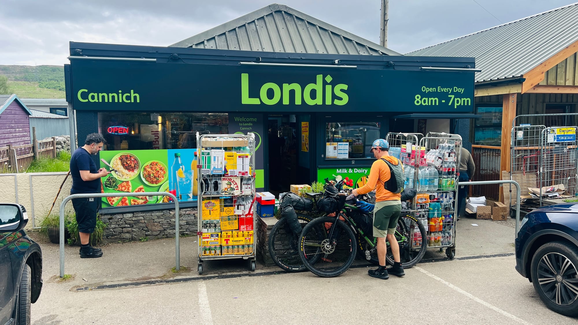
Cannich is the first, last and only place you will pass through that offers resupply options and other modern conveniences. Cannich has a campsite with pods that many hikers use for their first night on the trail. Being frugal and not liking campsites, we didn't stay here, although I have heard good things about the site, in particular their pods!
When you walk through Cannich, keep an eye out for the hundreds of teapots that line the walls of houses and even the school. The school also captured our attention. The school grounds are home to a flock of chickens! I've never seen a school with its own chickens! Eve and I thought this was brilliant!
Cannich has a wonderful community-owned shop and cafe. The shop is exceptionally well stocked with everything a hiker could want. The cafe located next door has a good range of hot food and drinks, the most famous of which are their pizzas! Given their location and a captive audience of hikers and bikers, I felt the prices were good when compared with other places we have walked through on Scotland's trails! The shop and cafe are next to each other, slightly off-trail, a few hundred feet along a flat road in the village centre. On a side note, the cafe's seating is currently in a converted double-decker bus, which it’s well known for! How long this will remain, I don’t know. When we were there, a new cafe was being built and was almost complete! Eve and I stopped at the shop. I had chips and cheese, and Eve had a pizza. They were excellent! We also bought a drink from the shop.
The walk out of Cannich was steep. Following the road uphill, with full stomachs, was hard going. Turning off the road, you will enter more forestry tracks. These tracks are active and used for logging. We passed several logging lorries and open quarries as we walked. Eventually, you turn off the track and onto a thin forest trail that leads you to the car park at Dog Falls.
Just before the car park at Dog Falls, you will pass a locked and gated tunnel. This is a functional part of the Affric-Beauly hydro-electric power scheme built around the time of the Second World War.
Wild camping between Cannich and Dog Falls, despite what some websites and social media pages will tell you, offered the sparsest choice of the whole trail. There was a large area to wild camp in the trees, on the left immediately as you come off the road, and that was about it until reaching Dog Falls. All other places would have to be ‘created’ by flattening some grass, finding an area between trees, or simply being lucky. My advice, as with all wild camping, is never to turn down a location that looks acceptable in the hopes of finding something better a little further on. We camped between Cannich and Dog Falls, beside the main track on a small patch of grass in front of a weir. All things considered, this was a great spot. It was flat and open, with a water source just behind us. Perfect!
Walking the Affric Kintail Way, you will come across these beasties. There is much to say about them, and advice I can give you, but the best advice I can offer is to go back to basics. Cover up - wear lightweight, bright clothes (not the black I usually wear), use a midge head net (not black, as this impedes vision) with a baseball cap to keep it out of your eyes, and a buff to protect your neck. Tuck socks into trousers or wear tight leggings. Do regular tick checks and carry tick removal tools. Avoid long grass and bracken when possible. Clegs are relentless and will bite through clothes! Avoid using chemicals DEET and Smidge, their effects are negligible in real-world conditions, and sweat will make them run off and sting your eyes or damage clothing and equipment. You could carry bite cream and an antihistamine, but speak to your pharmacist first and make sure you get one that doesn’t make you drowsy.
Dog Falls to Loch Affric
Dog Falls felt like the real start of the Affric Kintail Way. The terrain, views and general feel of the trail changed dramatically. Leaving Dog Falls, you start to feel as if you're walking into the Scottish wilderness.
As I mentioned before, some people start the Affric Kintail Way at Cannich however, I think Dog Falls would be a much better starting point than Cannich if you wanted to skip the first section.
Dog Falls is part of River Affric and is not so much a ‘waterfall’ as rough white water. It is, however, beautiful and majestic. The car park at Dog Falls is large and, as such, can get busy. It has limited facilities. It does have three compost toilets provided by Forestry and Land Scotland. There is no running water, and as such, no sinks! Eve and I made the most of the facilities and sat on the rocks by the water to cool off and watch other hikers brew coffee on camping stoves and take a dip. It felt like a very atmospheric place, helped, I think, by the sunshine and people's smiles! We liked it here.
Walking out of the Dog Falls over the bridge, the trail goes steeply uphill. Once at the top, there is a small viewpoint on the right. There is a small signpost; however, you could easily miss it in the undergrowth. The viewpoint is definitely worth visiting! The views over Loch Beinn a’ Mheadhoin are absolutely spectacular. At the viewpoint, there's a bench and a small plaque. This viewpoint is one of the first ‘real’ photo opportunities you will encounter. It is also one of the famous viewpoints along the Affric Kintail Way, so please don't miss it!
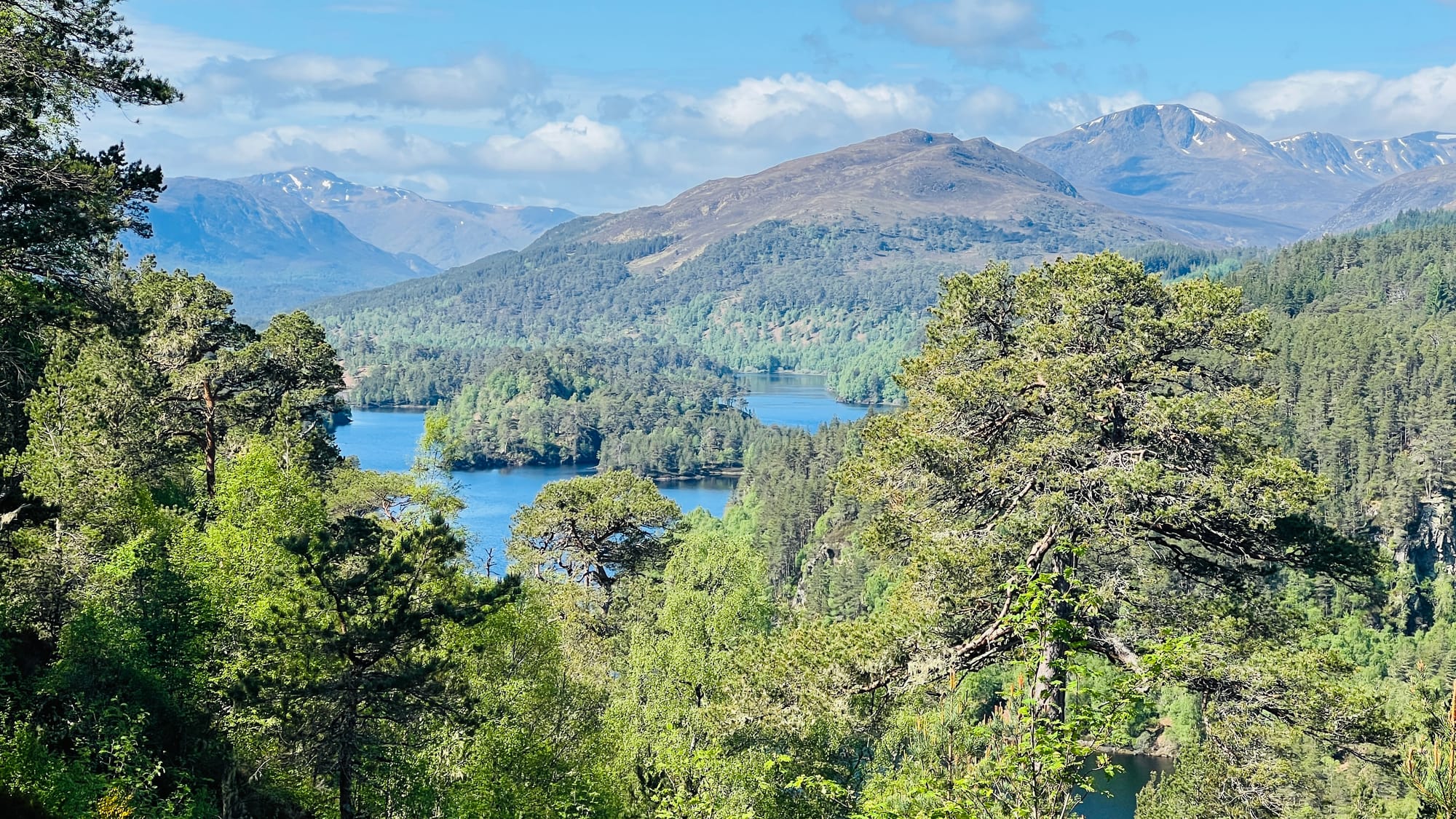
From here, the trail starts to change dramatically. Gone are the commercial forests and the Birch woodlands. Now you are entering the ancient Caledonian Forests. Walking this section, the trail is still a forest track wide enough for vehicles, but the whole feeling of the trail changes.
Reaching the end of Loch Beinn a’Mheadhoin will be your last opportunity for an easy escape route from the trail. There is a car park on the other side of the loch that you can reach with a small detour. This could be used if you are section hiking the trail or need to resupply from a support crew. Once past this spot, you will be on your own and entering Glen Affric, which will be a very different experience from what you have been walking through so far.
Wild camping on this stretch would be challenging. Throughout the Affric Kintail Way, this section was the hardest to find wild camping spots or suitable areas for the night. If you had to wild camp in this area, my advice would be to search along the loch shore, but that would still not guarantee you'd find anywhere. The other option is to camp at Dog Falls, around the car park. If you have children or are nervous, camping around car parks should be done with care, as very strange things can happen in secluded car parks at night, as Eve and I have found out! The best piece of advice I can offer is to keep walking until just before the start of Loch Affric. Beside the bridge over Allt Garbh, there is a wonderful area to wild camp. It’s next to the burn, and if we had arrived a few hours later in the day, we would have camped here.
It was just after Dog Falls that we started to lose mobile phone signal. Intermittently at first, before it dropped completely. The lack of phone signal in Glen Affric is well known and well documented. We were very happy it’s still a 'dead zone' and hope it doesn't get ‘fixed’ anytime soon! Being able to disconnect is medicine for the mind and soul and should be embraced by hikers and walkers. Please do not let a lack of phone signal put you off, but do be prepared to handle incidents without the convenience of immediate assistance or advice.
If a lack of phone signal or the ability to contact the emergency services is a red line preventing you from walking the Affric Kintailn Way, there are options you can consider. You could purchase a satellite communication device. There are many to choose from, but each has a monthly cost. Newer Smartphones, such as the iPhone, even have a basic satellite SOS feature built in, so do some research as it might save you some money.
What we do, given the amount of hiking Eve and I do, is we both carry a satellite communicator. I have a Garmin inReach, and Eve has a SPOT Gen 4. We can't recommend these highly enough and there are good reasons why we each have these specific devices. The budget choice, however, is definitely the SPOT Gen 4, albeit with reduced functions - perfect for a child!
Has this article helped you?
If it has helped you in any way, please consider saying thanks by buying us a hot drink or slice of cake on Buy Me a Coffee. Thank you. Ian & Eve
Loch Affric to Glen Affric
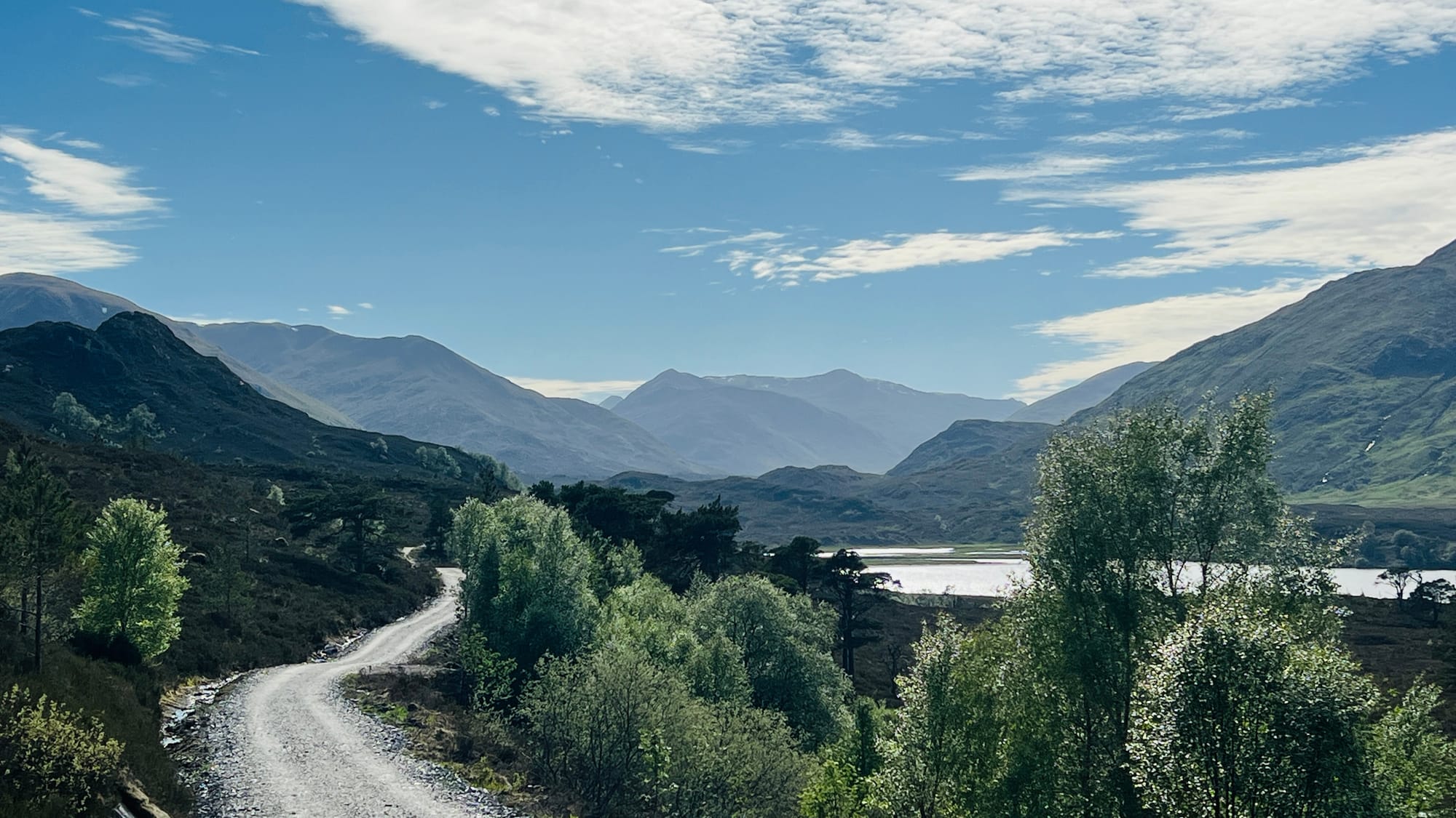
Until now, the views had gradually become more dramatic, with mountain peaks and rocky crags visible above the treetops. Reaching Loch Affric, that all changes, almost instantly. Gone are the woodlands and forests, replaced by open vistas as far as the eye can see. Mountains towering on either side with the Loch below. It was as if we had entered a different world or stepped into a scene from Lord of the Rings. The change was inspirational and motivational.
With no trees to offer shade or protection from the wind, the temperature felt a few degrees cooler - at the time, it was a welcome relief with an oncoming head wave. The wind picked up to a gentle breeze as the sun beat down on our heads with no tree canopy to offer shade. We walked with newfound energy and motivation under the gaze of the mountains. This is what the Affric Kintail Way is all about and what we had been hoping for. It was magnificent and gets better the further you walk along the loch.
The trail underfoot started to feel slightly more rugged, albeit still vehicle-worthy. If I had one complaint about the trail up until now, it would be the lack of variety underfoot. Most of the trail up until now had been on gently undulating forest trails, where seeing a logging lorry or 4x4 wouldn't have surprised us. As it happens, we didn't see any vehicles, but we passed many people and other hikers. At the end of Loch Affric, the trail underfoot changes and becomes increasingly rough.
Wild camping along Loch Affric is possible, however, finding a spot isn’t as easy as I would have expected. The obvious choice would be to deviate and drop onto the banks of the loch; however, there is a deer fence, and the terrain to reach it would be a challenge for all but the most committed. The hardest thing would be walking back up onto the trail in the morning. The best options we saw were on the opposite side, slightly uphill on the small peaks and other knolls. Being confident to pitch a tent in the heather or long mountain grasses would be good. We did see a few places where you could camp right on the edge of the trail if you had a small tent, and happy to have people walking within a metre ot two of your pitch. We personally prefer to isolate ourselves and be out of view. This isn't always possible, however!
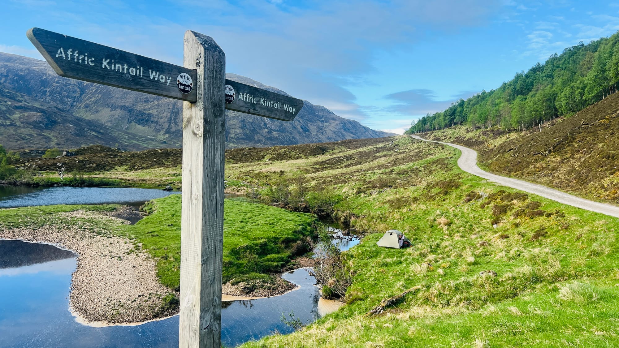
The best wild camping, however, can be found at the end of Loch Affric, where there are near-infinite options and locations of every type to choose from. You will be spoilt for choice! A well-known spot is at the top of the loch, on a wide-open area of grass. However, you will probably be sharing the area with other people, including paddlers and families in large tents, who access it by small motorised boats. This is what we saw, as this was where we had planned to camp. We walked on to avoid the crowds and found a wee spot on the edge of River Affric, beside a small island.
The Affric Kintail Way is extremely well signposted throughout, with the vast majority of it following easy-to-walk paths and trails, even if short sections are a little rough underfoot. For roughly the first quarter, you will be walking along forest tracks, and the last few miles are on a rough track. The rest of the Affric Kintail Way is on a mixture of rocky trail, following rivers, contouring along hillsides, or undulating over small mounds. There is a very short section after the youth hostel that can be boggy, and you might find it hard to follow in poor weather, but nothing a simple compass bearing couldn’t solve!
River Affric to Camban Bothy
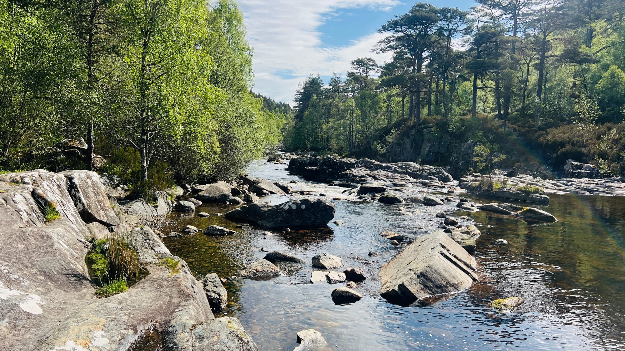
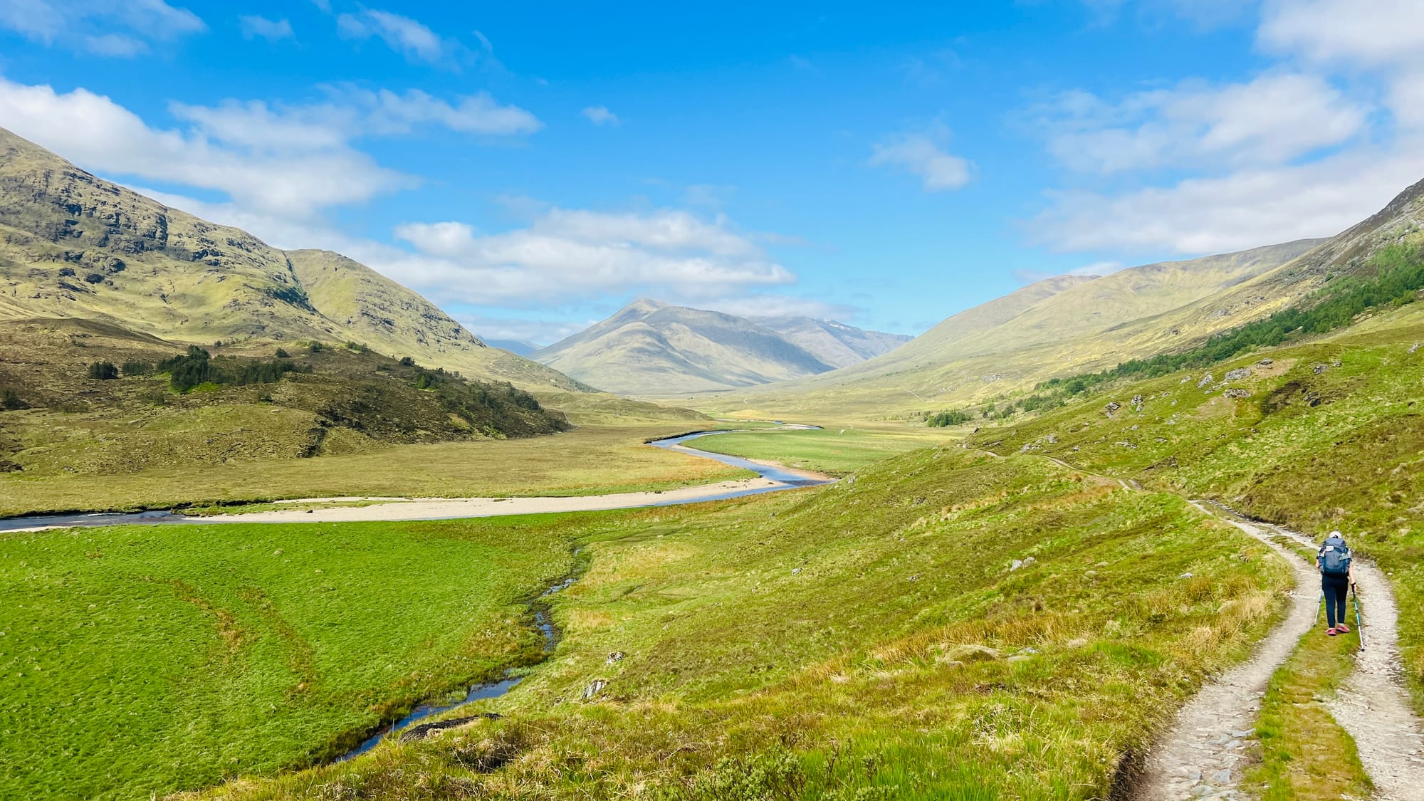
The end of Loch Affric marks another distinct change on the Affric Kintail Way. The wide tracks give way to a thin, rocky trail accessible only on foot or by bike. For us, this was a welcome change, almost a relief to walk on surfaces made for feet. At no point is the Affric Kintail Way a difficult or particularly challenging trail, but it started to feel more like it now. Eve and I were surprised to see how busy this section of the trail was. Walkers of every age, from people who looked as if they were on a military-style expedition behind enemy lines to those who looked as if they were on a Sunday afternoon stroll around an urban playpark. It felt slightly odd to see people with such different approaches to hiking in the hills. Above all, what stood out was that absolutely everybody was in good spirits and looked as if they were having the time of their lives! People spoke, smiled and stopped to talk. As much as we prefer our own space and solitude, we didn't feel imposed upon or overwhelmed when people did stop to talk. It was pleasant, and we enjoyed every interaction!
The one regret we have about our hike along the Affric Kintail Way was not going for a swim in the River Affric. The river was wide and shallow, with occasional deeper areas that looked as perfect for wild swimming as I have ever seen. The water was also crystal clear and inviting! I'm not sure why we didn’t have a dip, but I know we regret it! The good thing is, we have the perfect excuse to return!
The section from River Affric to Camban Bothy was our favourite. The section from Camban Bothy a close second.
As for wild camping, take your pick! There are quite literally endless places to pitch up on this entire section. On a warm evening, beside the River Affric, I can't think of a nicer place to watch the sun set whilst having a cooling dip in the crystal clear water! Heaven! If you need to seek shelter, then a little further on you have a youth hostel and a bothy!
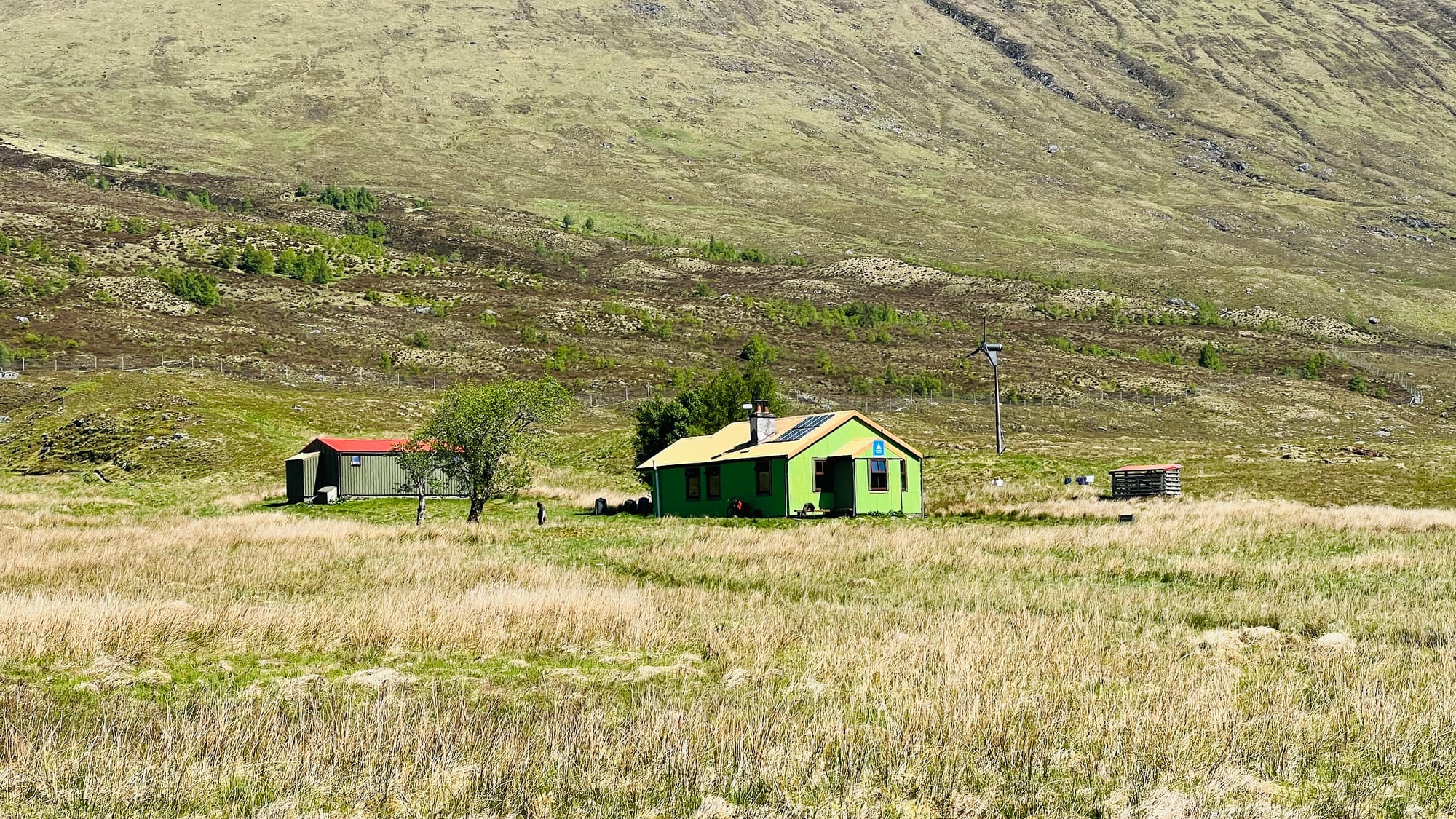
Alltbeithe Youth Hostel
Roughly midway between Loch Affric and Camban Bothy is the Alltbeithe Youth Hostel. An off-grid, eco-friendly former stalker's lodge 8 miles from the nearest road, it's an odd and bizarre sight to see in such a remote area of Scotland! Not only that, but they have a small over-the-counter shop selling drinks and other snacks.
Eve and I had hoped to grab a drink, but the hostel only opens at 5 pm. We arrived about midday to find another gentleman sitting outside with exactly the same hope we had! A cold drink on a hot day. We were all disappointed. Moral of that story - check the opening times more carefully and always have a backup. In fairness to us, we had checked the website hoping to book one of the two private rooms for us to stay in, but were told that under-16s were not permitted to stay. I’m not sure if this is correct, but given the time we reached the hostel, I'm not sure how useful it would have been. We are pleased to have seen it.
The other thing I have been told about the hostel is that, out of season (winter), when it’s closed, they leave an emergency room open for people who are caught out in the weather. There are no facilities much like a mountain bothy, but it's useful to know if you are walking the Affric Kintail Way out of season and get caught out in a storm!
Walking on from the Youth Hostel, the trail underfoot changes once again. Now the trail crosses a wet and boggy section where keeping dry feet is a challenge. The trail isn’t hard to follow, and it’s exceptionally well signposted throughout. But in thick fog or lack of concentration, you could inadvertently come off the path.
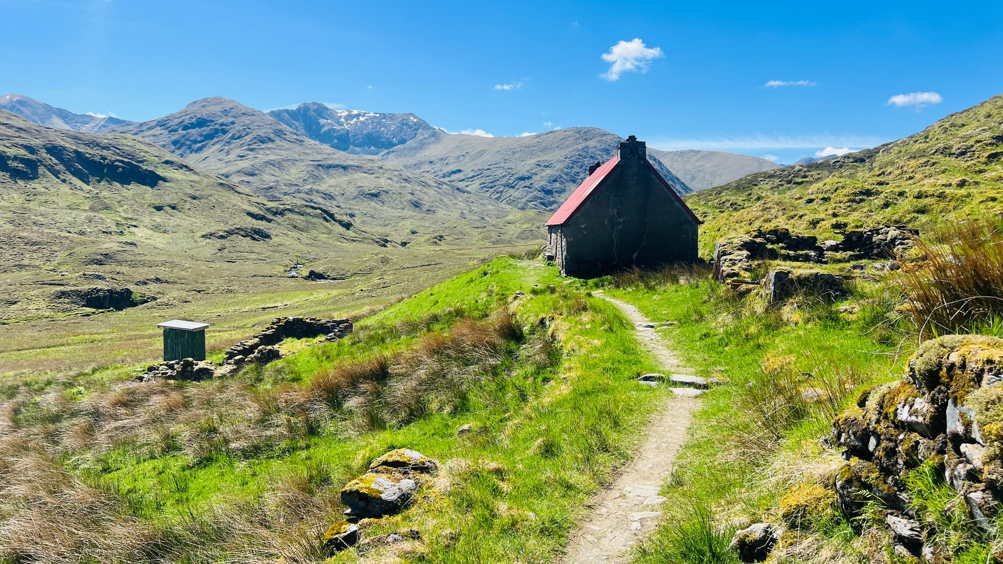
Camban Bothy
Camban Bothy is relatively unique because it's one of the few bothies with a toilet. The toilet has one of the best views from any ‘facility’ we have used! The bothy is owned by the National Trust for Scotland and cared for by the amazing Mountain Bothy Association (MBA) and its volunteers, to whom Eve and I are so grateful. It has two rooms and plenty of sleeping space. As much as we love a bothy, I'm always nervous about sleeping in one with Eve. I am sure that, given the isolated location, this bothy would be fine, but we've been at bothies where people have arrived for a night of drinking and partying! It’s definitely put us off, but it shouldn't put you off! They are great places, where most people you will meet are just like you, hikers just looking for a quiet night or brief shelter to enjoy a break!
Eve and I predominantly hike in non-waterproof trail runners. Years of hiking have taught us the benefits of this and the importance of avoiding waterproof boots. Even on this ‘wet’ section, our feet remained dry with some careful route selection. At no point on the entire Affric Kintail Way do we feel the need for or want our heavy waterproof hiking boots. We do, however, always carry waterproof socks. If you are in any doubt about this approach, we have walked Scottish trails throughout winter using the same approach. It has its drawbacks, but under all but extreme conditions, I would use the same system!
Canban Bothy to River Croe / Gleann Lichd
This short section from Canban Bothy is arguably the most changeable, dramatic and mountainous trail walking on the entire Affric Kintail Way. The trail is a thin, rocky path that undulates and offers very little shelter from the elements, except for the occasional lump or bump to hide behind to escape the prevailing wind. You might see a few brave cyclists on this section, but you will mainly see other Affric Kintail Walkers.
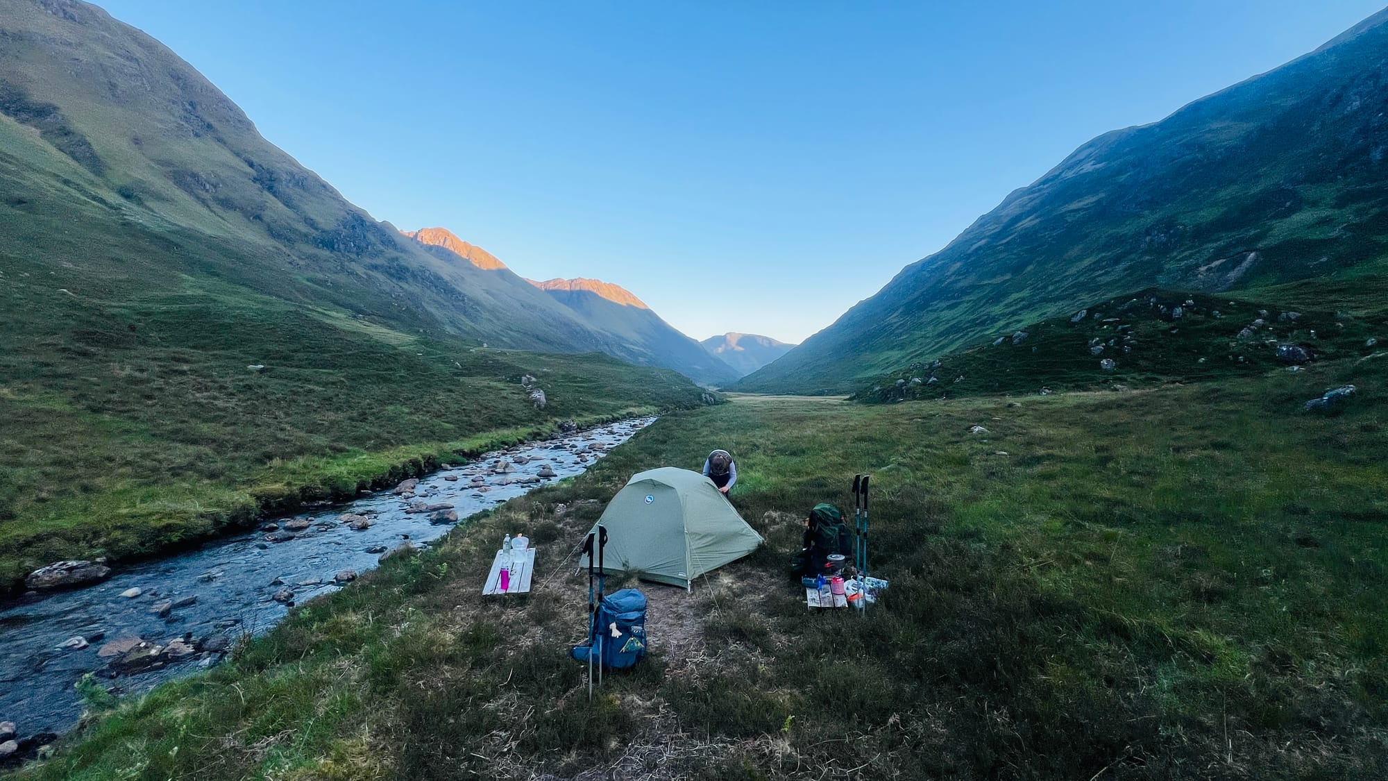
The most dramatic section is the waterfall on Allt Grannda. The area feels like you're descending into the depths of a mountain, whilst hugging the edge, around a steep drop on loose scree from recent rockfalls. It really is otherworldly, and there are even a few potential wild camping spots close by! The walking is safe, and although some people make it sound death-defying, it's really not that bad. If you are on a bike or walking in severe winter conditions, extra care is needed, but no more than on any other section of trail where a fall could occur if you lose your footing. Enjoy it, it's one of the highlights!

We camped where the Affric Kintail Way crosses the burn at the head of River Croe just beside the footbridge. As with previous sections, you will be spoilt for choice when it comes to camping spots, and we had no issue finding one that had been used by other walkers. In fact, in the morning when we started walking, we walked past two other tents, the first backpacking tents we had seen on the trail.
We carried the Harvey Affric Kintail Way XT40 map along with a compass. It’s always highly advisable not to rely solely on your phone or GPS, regardless of how ‘bomb proof’ you think your technology is. We have had failures with the phone, GPS and battery several times. Using a touchscreen in the wet or with freezing hands is all but impossible. We have had to fall back on traditional navigational methods more times than I can remember! I strongly advise you, regardless of how confident you are, to carry a map and compass! However, to be honest, we didn’t look at the map much at all as the trail is so well signposted! We had the Affric Kintail Way route downloaded to my iPhone. We use both Outdoor Active and OS Maps, and have subscriptions to both.
Gleann Lichd to Morvich
We set the alarm for 5 am this morning to walk the last few miles in the cool morning air. Eve was also excited to speak to her mum as we still didn't have any phone signal. The trail briefly followed a rough path past the Glen Licht House.
Glen Licht House (Hadden Woodburn Memorial Hut)
Glen Licht House, known as the Hadden Woodburn Memorial Hut, is owned by the University of Edinburgh and can be rented out. I didn’t know about the hut before we started the Affric Kintail Way, although I don't think we would have used it anyway. It is useful to know about it, however, if you choose to start the trail from Morvich, as it could offer the perfect place for your first night!
At the Glen Licht House (Hadden Woodburn Memorial Hut), the trail, without warning, puts you onto a long track that leads you all the way down the glen almost to Morvich. The trail is easy to walk but is clearly used by local farmers and others, including for access to the hut.

As you walk down the trail, you can feel it change from a rugged mountain track to something much softer and flatter, and see the first signs of ‘the real world’ returning. It was only now that our phone signal started to return. Eve took the opportunity to phone Sarah, very excitedly! It was so nice to hear Sarah’s voice, and she was relieved to hear ours for the first time in 3 days! Further on, you pass over a number of cattle grids and walk past lots of farm equipment, eventually arriving at a road. But… don’t walk down the road!
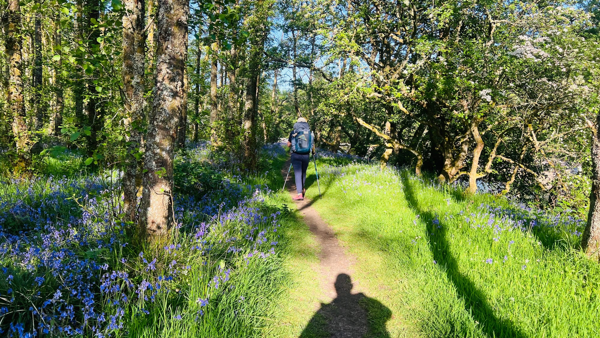
At this point, you are very close to Morvich, and walking down the road seems the obvious choice. However, across the road there’s a small signpost directing you down a small gap in the hedge and into a small wooded area that follows the river. This woodland is beautiful. The entire woodland was carpeted with bluebells, and as the river gently flowed past, we listened to the sound of water gurgling and splashing as if playing in the eddies and encouraging us on the last short section to Morvich. It was idyllic. Best of all, we avoided walking on the tarmac!
As with all good things, it has to come to an end. The wooded area ended, and the last few metres were on tarmac into Morvich. We passed a Camping and Caravan site where we saw several backpackers packing up. Whether they were starting the Affric Kintail Way, I don't know, but if you needed somewhere to stay with all the modern conveniences of a campsite, you couldn't go far wrong. There is also a small shop on site.
Finishing the Affric Kintail Way
The end of the Affric Kintail Way is much like the start, undefined. The end of the trail is generally considered to be the car park opposite the Kintail Ranger Service Station and the Kintail Mountain Rescue Team building.
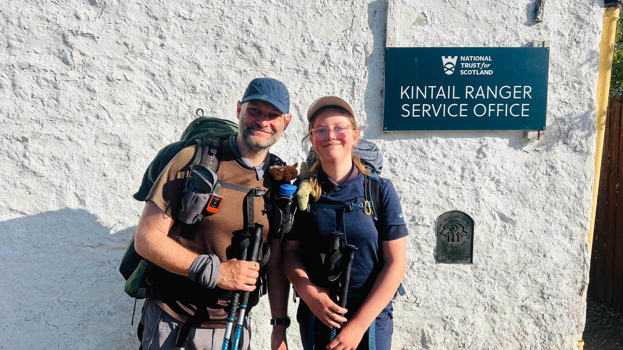
The car park isn't big, but there is sufficient room for about 20 cars, which is where we had left our car before getting dropped off in Drumnadrochit by Sarah. You can see the start on Google Maps
You have very limited options for resupplying or buying snacks along the Affric Kintail Way. There is a very well-stocked shop in Cannich next to the cafe. Cannich also has a campsite, although I don't know if it has a shop. The Youth Hostel has an over-the-counter shop for chcolate bars and cans of drink, but with very limited stock. There are, however, plenty of options in Drumnadrochit and a small campsite shop in Morvich, although I didn't go into the shop to see what it sells.
Summary of the Affric Kintail Way
The Affric Kintail Way isn’t the longest or the hardest of Scotland's long-distance trails, but it definitely punches above its weight. Glen Affric is considered by many to be the most beautiful of all of Scotland's glens, and we can see why! It really is idyllic, majestic and magnificent all at the same time. Eve and I both agreed it is one of the most beautiful glens we have walked through. We were blessed with good weather, but in poor weather, it would be a very different experience. We had an amazing time, and we wholeheartedly recommend it to novices and experienced hikers alike. You will not be disappointed. There is so much to see and do on the trail, and if you are really keen, you could even bag a Munro or two en-route!
“I hope you enjoyed this report, but most of all, found it useful in planning your own hike. If you have any questions, please get in touch, and I will be only too happy to help.”
Has this article helped you?
If it has helped you in any way, please consider saying thanks by buying us a hot drink or slice of cake on Buy Me a Coffee. Thank you. Ian & Eve


Comments